
This is the second of seven posts covering all of the ideas generated at the Somerville by Design: Davis Square Design Charrette that was held September 9-11, 2013. We have numbered all of the images so that it is easier to reference them when providing feedback.
You can send us feedback two ways: first, you can discuss a specific idea online by leaving a comment at the bottom of this blog post. Second, you can provide feedback using a feedback form that you can download (Pin-Up Feedback Form) and mail back to us using the address below. The form is designed to facilitate feedback for all of the ideas generated (over 45 in total) and should be used for all of the forthcoming blog posts, not just this one.
Mayor’s Office of Strategic Planning and Community Development
c/o Somerville by Design
93 Highland Ave.
Somerville, MA 02143
All of the images on this post can be downloaded as a .pdf here: Pin-Up Ideas 2
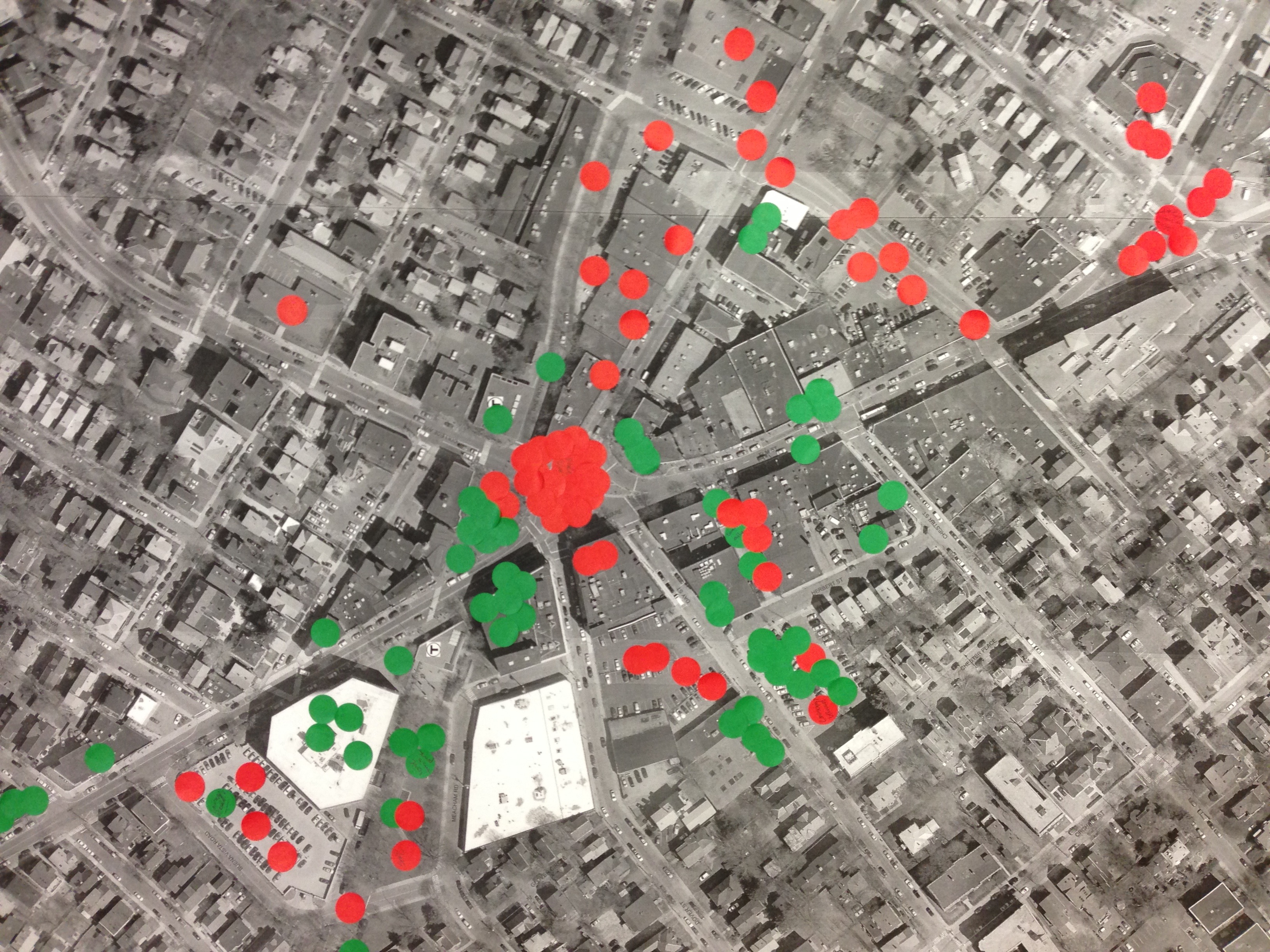
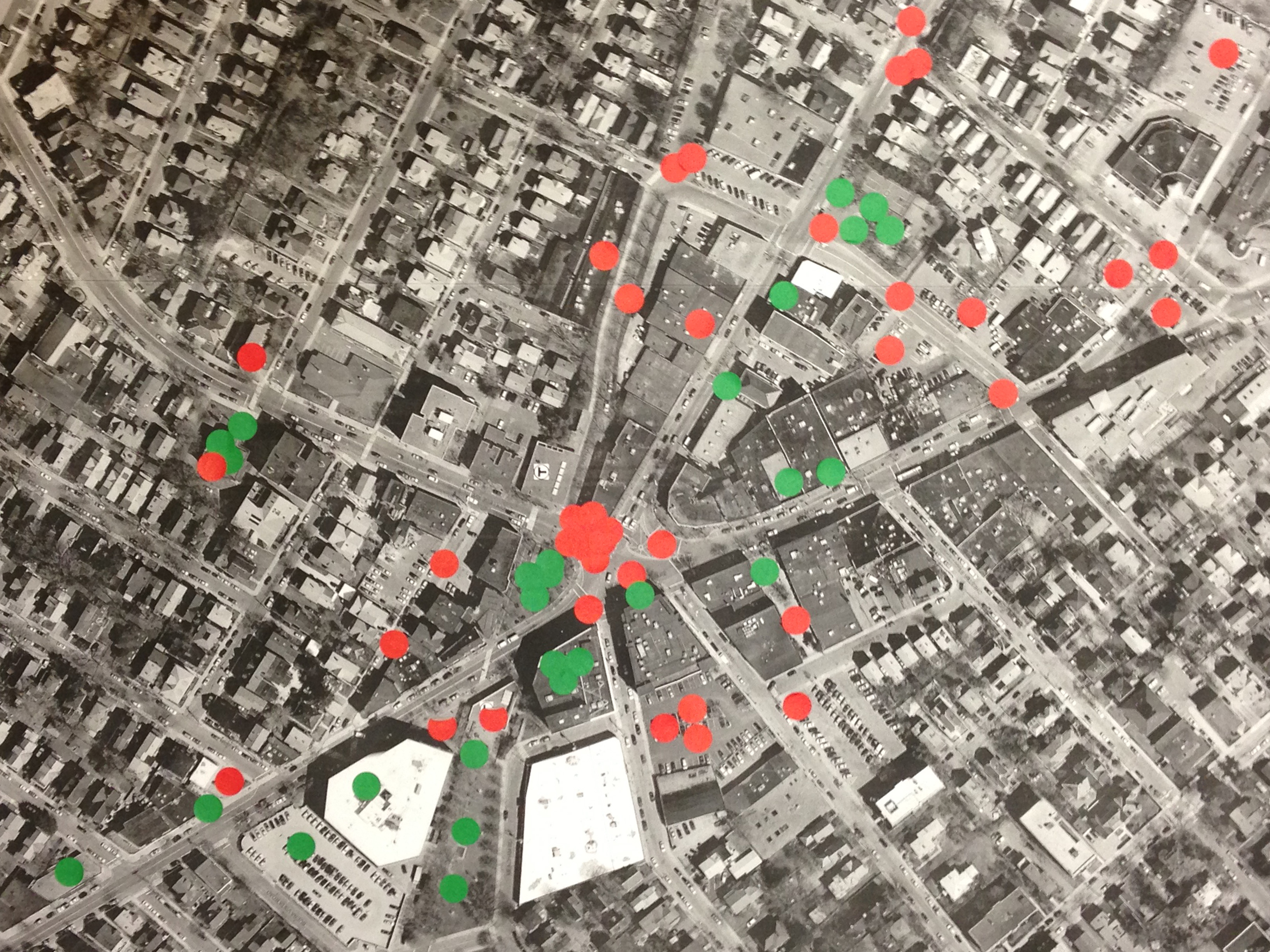
Do you recognize the two images below? These satellite photos covered in red and green dots were created by participants at the two Visioning Sessions held prior to the Davis Square Design Charrette. The maps illustrate feedback on both the “good” and the “bad” of the neighborhood. Participants were given 3 of each color and asked to place them on the map as they wish. The dots tend to speak for themselves, and as a form of crowdsourced feedback, multiple dots clustered on a specific spot identify areas problematic for multiple people.
There are a few spots identified as needing some attention, but one in particular jumps off the page for both maps: the main intersection of Davis Square.
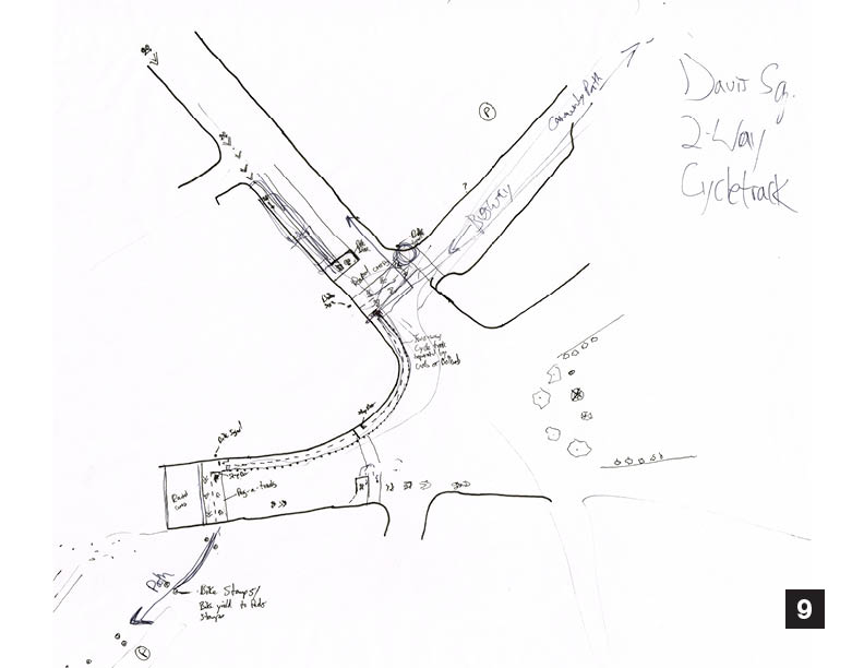
Concept 9
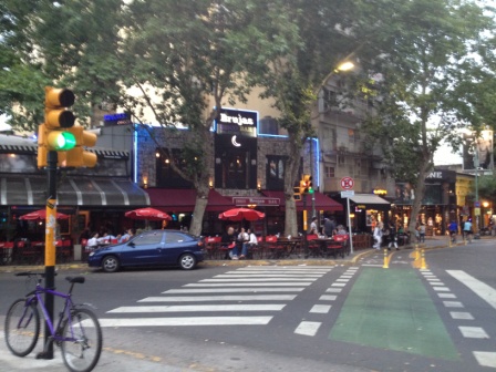
The Somerville Community Path is a recreational and commuting resource for local residents as well as the regional population. For many years, the City and its partners have worked to improve the path connections across Davis Square. Participants in the “Somerville by Design” process tested several ideas, both new and old.
This sketch imagines a two-way cycle track following the curve of Statue Plaza from College Avenue to Holland Street. The cycle track would be separated from the street, and from the plaza by curbs or flexible bollards. A raised crossing is installed on College Avenue, much like the one recently installed on Holland Street. Bike signals would be installed at each crossing, and a stop bar is shown at the pedestrian crosswalk connecting Mr. Crepe to Statue Plaza.
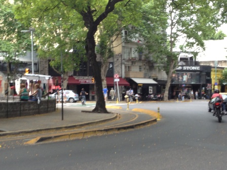
On Holland, new surface materials are shown just east of the existing raised crossing, leaving the raised crossing for use by pedestrians but not bicycles. Riders are directly connected to the newly paved path section between the MBTA head house and the Somerville Theatre, reducing the number of cyclists riding underneath the Holland Street head house canopy.
Concept 10
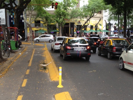
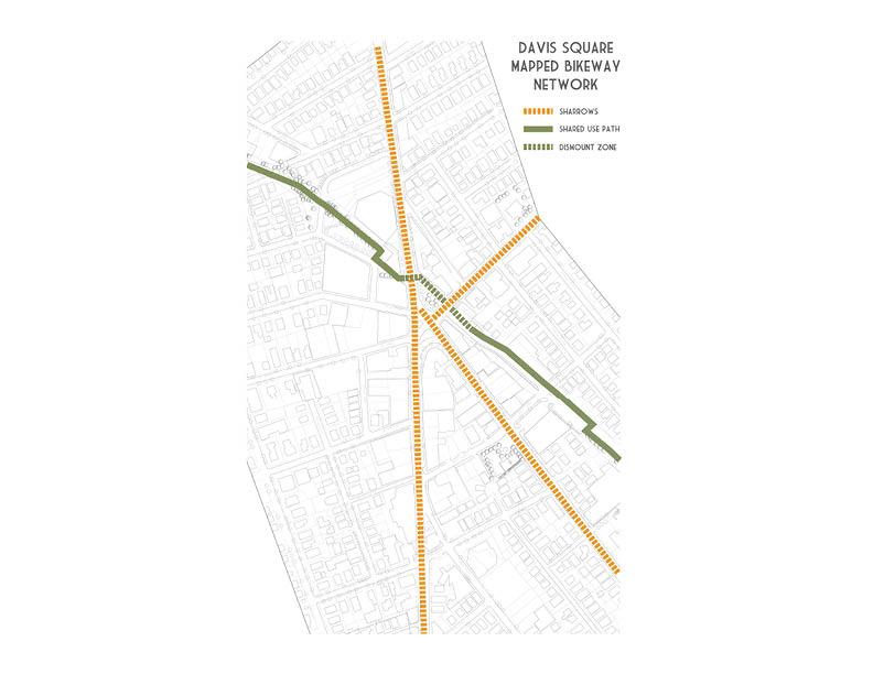
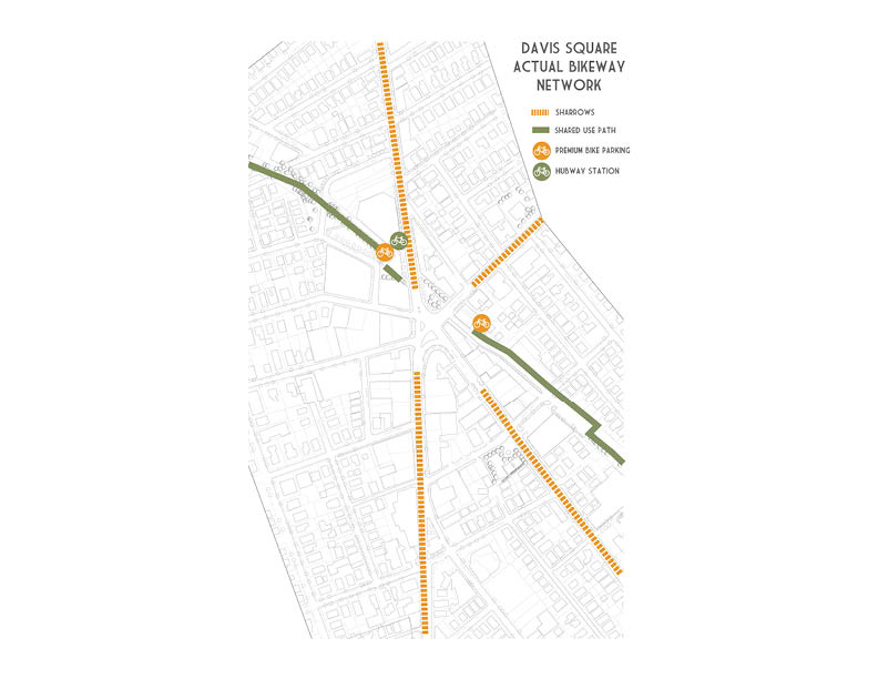
The mapped bikeway network through Davis Square and the actual bikeway network live in different worlds. Today many bicyclists either have to dismount and walk their bikes through Statue Park to the western connection of the Somerville Community Path beyond the red line head house on Holland Street, or they fight through heavy pedestrian traffic while still riding across the square. We have yet to observe any bicyclists using the street connection to avoid riding (or walking) through Stature Park.
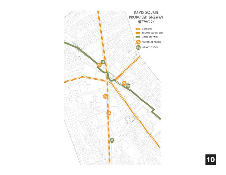
Consultants and City Staff have been working hard to brainstorm both potential new routes and/or infrastructure improvements that could help alleviate conflicts between pedestrians, bicyclists, and cars through the square. This series of diagrams proposes increased bike parking facilities to relieve congestion at existing facilities and two possible locations for a second Hubway Station in Davis Square. The diagram also identifies the importance of finding a solution to connecting either end of the Community Path through Davis Square as discussed in Concept 9 (above).
Concept 11
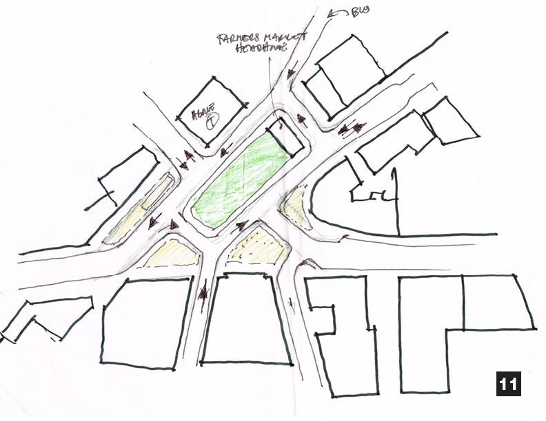
This scenario assumes restoration of two-way traffic on Highland Avenue as well as redevelopment of the Middlesex Bank property. Statue Plaza is shifted to a central location, with a rectangular shape (a smaller pedestrian plaza is retained in front of JP Licks and Boston Burger). This sketch envisions a structured canopy for Farmers’ Market / Flea Market uses. Larger pedestrian plazas are created in front of the Somerville Theatre, One Davis Square, and Mike’s Pizzeria.
Concept 12
This idea also keeps one-way and two-way streets, as well as all buildings facing the square in their present configuration. The major change is expanding the size of Statue Plaza and shifting its location into the middle of the intersection. All traffic from College Avenue and Highland Avenue would be routed around the new plaza. Major sidewalk widenings occur in front of Middlesex Bank and Mike’s Pizzeria.
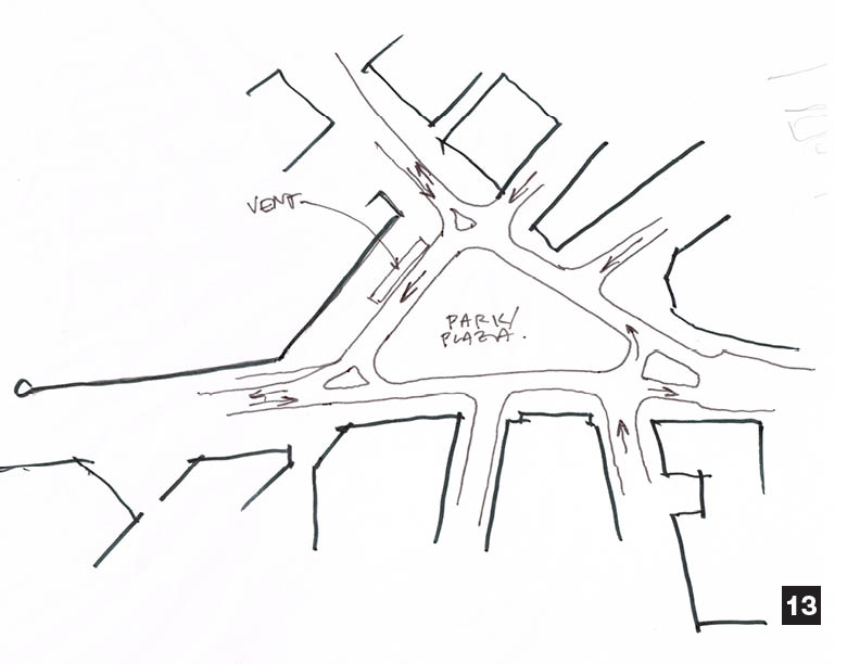
Concept 13
There is a small difference between Concept 12 and 13. Concept 13 maintains the MBTA vent in Statue Park. If the vent is maintained in the current location, the proposed Park/Plaza is smaller.
Concept 14
This idea reduces the space dedicated to cars in the heart of the intersection. The pedestrian island currently in front of Mike’s Pizzeria is enlarged and shifted to a location in front of Middlesex Bank, which separates traffic entering the square from College Avenue and Highland Avenue. All existing one-way and two-way regulations remain consistent.
Concept 15
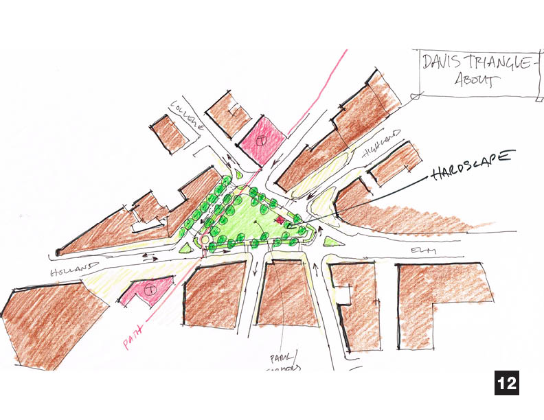
Another variation on the intersection improvement creates new pedestrian amenities by closing the last block of both Highland Avenue and the MBTA Busway. A small, iconic “flatiron” building is constructed between Middlesex Bank and Blue Shirt Café, creating memorable views along Highland Avenue and from the Holland Street Red Line entrance. Villa Avenue and Grove Street are re-connected to the busway. Meacham Road is re-routed to support an expansion of Seven Hills Park, which includes a permanent bandshell facility.
This sketch also shows several long-range redevelopment concepts. The Highland Avenue Rite-Aid property is redeveloped, creating a pedestrian-friendly urban corner at Highland and Grove Street. Dover Plaza (the one-story office building at Dover Street and Meacham Road) is redeveloped into a more urban form. A smaller redevelopment concept is shown north of the busway, between College Avenue and Villa Avenue. Small infill buildings are also shown on the Ideal Engine site between Day Street and Dover Street, and an outdoor stage is imagined at the rear of the One Davis Square building.
Concept 16
This sketch cleans up the main intersection by interrupting the eastbound flow from Holland Street to Elm Street with a large pedestrian plaza in front of One Davis Square, which creates a four-way intersection. Highland Avenue is transformed into a shared street for buses, pedestrians, and commercial loading. Westbound automobile traffic on Highland is routed through the existing MBTA busway. This scenario could offer the benefit of bringing Highland Avenue to life as a pedestrian block.
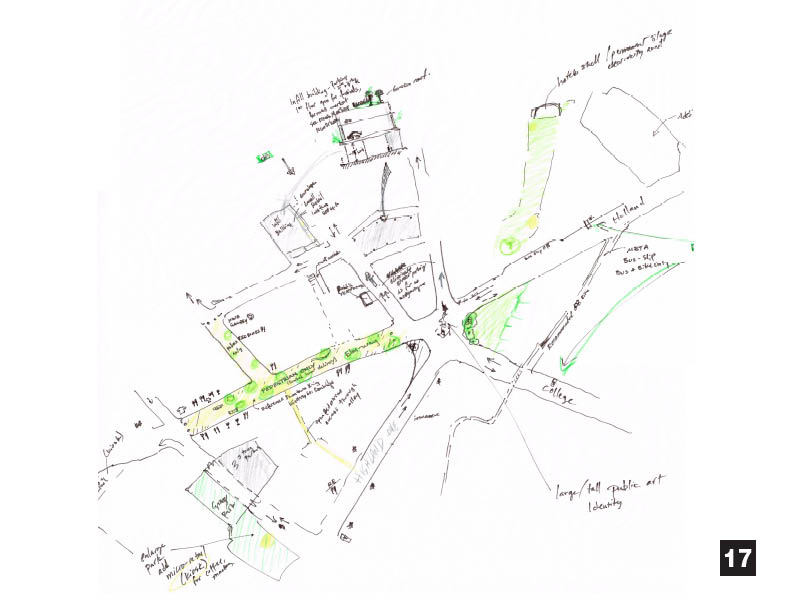
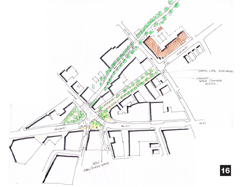
Concept 17
Concept 17 was created by a local charrette participant and shows a variety of ideas (please note that this sketch is ‘upside down,’ One Davis Square is at the top of the sketch). Elm Street (from College to Grove) and Chester Street (from Herbert to Elm)are turned into pedestrian streets. Day Street is turned into a two-way street between Herbert and Mass Ave. Statue Park is expanded as well as the public space in front of Mike’s. Kenney Park is expanded south toward Elm Street, and a pedestrian alley is opened between Elm and Highland. There is an infill development behind One Davis Square, where a private parking lot is today, to create a transition from the residential neighborhood to Davis Square.
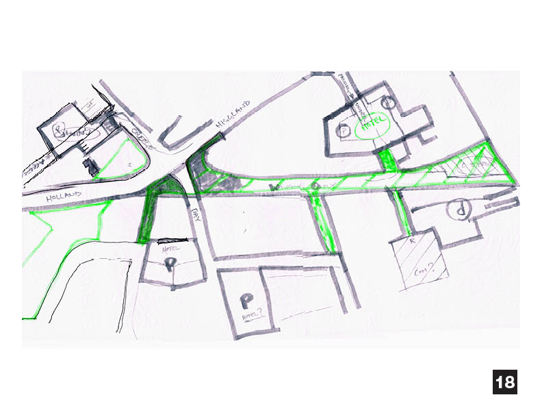
Concept 18
Concept 18 was created by a local charrette participant and shows major intersection changes in the Square. Holland, Highland, College, and Day Streets form the main intersection. Elm from the square to Cutter, Chester from Elm to Herbert, and Bowers from Elm to Cottage, and the bottom of Grove Street are turned into pedestrian streets. Parking is a shared resourced located primarily in lots/garages. A hotel development is located over a municipal garage on Grove Street.
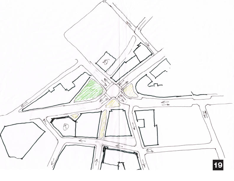
Concept 19
A modified version of the four-way intersection closes Dover Street between the square and Meacham Road. By swinging Holland Street slightly north around a pedestrian plaza at One Davis Square, a regular four-way intersection is created. This sketch shows two-way traffic on Elm Street and Highland Avenue, but the concept could be built even if the current traffic pattern was maintained. Circulation south of the square is improved by creating a connection street between Day and Dover across the privately-owned parking lot behind One Davis Square.
Rosemary Broome-Bingham
Jeffrey L
Jeff R.
L. Davis